Driving up and down the mountain to our house, I forget what 2,000 feet of elevation really means. The way to know the land is to walk.
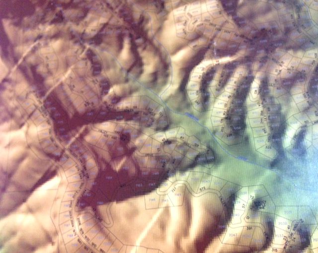
When I look at a topographical map, I can situate myself in the larger environment. Imagine what it was like for the pioneers. They knew to follow rivers, and how to look for the gaps between mountains. The land was in their legs every day.
Once in awhile, I like to feel the land with my legs the way they did.
Today I have a task with two rewards. I need to get Zoe, the convertible, from the rental to the house. Since Tom can’t drive, the normal approach would be to ask a friend to drive me to the rental, and drive Zoe back from there.
The weather has given me a gift. It’s in the mid 60s and no rain. I’m going to hike those five miles from Azalea to the rental.
I know the way.
Our backyard borders dedicated green space of the valley. It’s a five-minute clamber downhill, over fallen limbs and with careful steps in and out of dead leaf piles, mindful that there could be an ankle-twisting hole underneath. Most of the way is clear, though, because gravity and rain sweep this slope in its easy cascade to the creek.
That’s the creek we can hear from the house when the heavier rains fill it to a roar. Hard to cross then, but it’s been dry, so I scarcely have to pay attention to keep my boots from getting soaked.
In a few dozen steps, I connect to the trail that runs through the valley. Familiar turns and connectors.
It’s only 10 minutes to the lower falls, right after the fallen sourwood that once fed a yellow-bellied sapsucker. I’m pleased to see the falls are back to life after the autumn drought.
The trail follows the contour of a hillside, where I can take close remembrance of the mountain laurel thicket that was dismembered after a storm took down the big oaks and pines around it. Workers were more than a week in clearing that part of the trail.
Cranefly orchid leaves poke out from the side of the trail at regular intervals. I smile, remembering my first hike after brain surgery, more than a year ago, and how the cranefly orchid pointed the way to this future.
Twenty minutes on from the falls, I’m at the main road that meanders through our community. It’s not busy but the cars do tend to speed through here, myself included. Crossing the road is a reminder of why I’m doing this hike. The asphalt feels clunky under my boots and I’m glad to hit dirt again, following the stream.
On this warm Friday, I cross paths with eight people – more than the usual number of January weekday hikers. Everyone’s full of greetings and smiles. Neighbors or visitors, we’re all appreciators of the forest and the chance to be in it.
In this stretch, the dirt is softer. I recall the wet spring when this lowland was soaked and Jack-in-the-Pulpits sprang up by the dozen.
Winter gives the running pine its props, the fullest green to compete with the rhododendrons and laurel. I touch tree trunks in between taps of my hiking poles, then stop to lean on a large trunk, letting it absorb my worries.
It’s less than half an hour from the road crossing before I’m in so-called civilization, the village at the center of the community. We have a rock slide that comes off our swimming lake, and I promise myself that this summer I’ll go down it again.
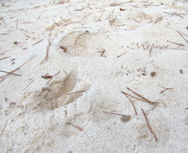
On a little stretch of sandy beach, I muse over the animal tracks. Deer, raccoon and squirrel are plain enough, but is that other one a bear or a dog?
If I had more time before dark, I could take the long way home, picking up a different trail after darting across the golf course. Today, though, about 35 minutes of road march gets me back to the neighborhood of the rental and off the main road.
I’ve never walked this stretch before, and though there’s enough shoulder to protect me most of the way, the cars distract me often from my long gaze down into the gullies. Sure seems like the traffic is a lot heavier now than it was when we moved here.
These are the places I’m normally passing at 25 or 35 mph, so the chance to see them at human level makes it worthwhile to dodge the cars. In the winter, there’s less flora to note, but I think I’ll do this walk again come spring.
I’m back at the rental, about an hour and 45 minutes all told.
Just as I’m heading up to the deck, a pile of feathers stops me. I drop to my knees to mourn the bird that wore them.
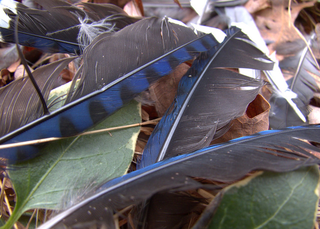
I contemplate the frailty of life and the strength of the land.
As I stand up, my cell phone rings. A foreign sound. I sigh, and answer.
Today’s penny is a 2014, the year that the latest topo map of our community was printed.